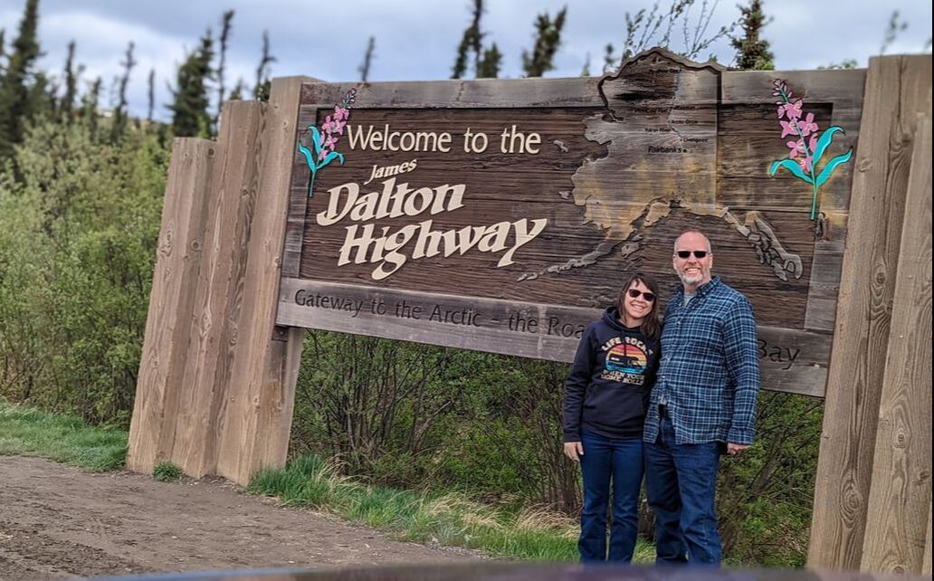
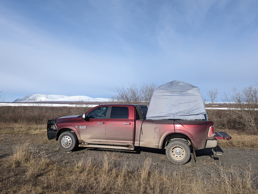
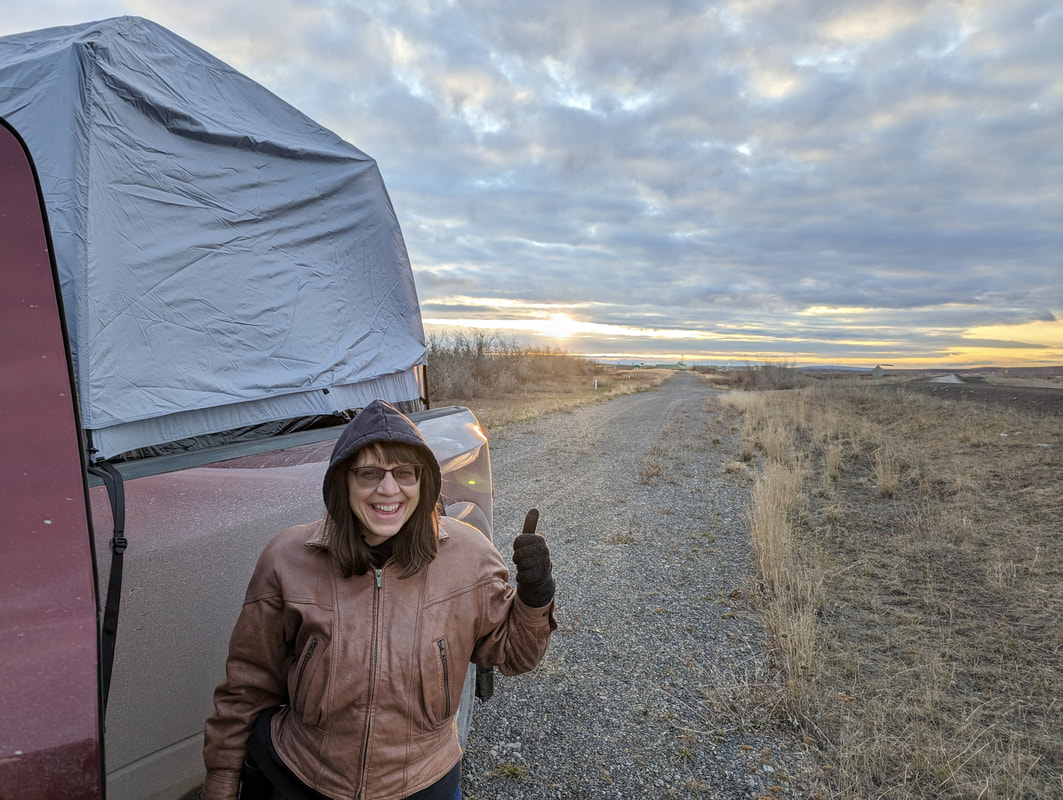
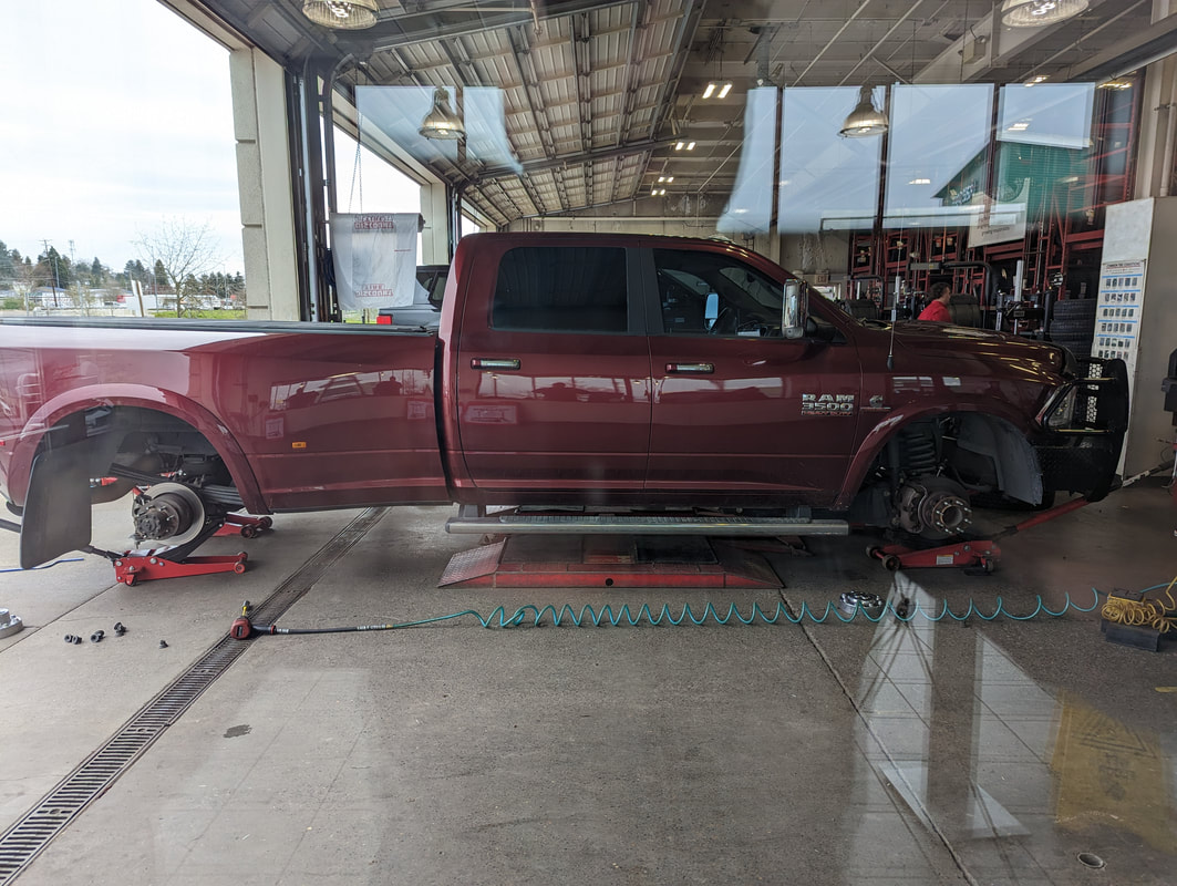
 If you had the chance to go to the Arctic Ocean, would you take it? We had that opportunity and jumped at it, but it took a lot of preparation. Getting to the Arctic Ocean in Alaska requires flying to Prudhoe Bay or driving the 414-mile Dalton Highway. Since we travel the country in our fifth wheel RV, we chose the latter option — but we didn’t take the RV. Road Conditions Known to locals as “the Haul Road” because of its heavy truck traffic, the Dalton Highway follows the Trans-Alaska Pipeline System between Fairbanks and Deadhorse. 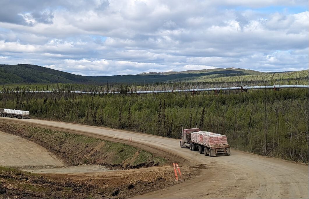 We had heard that the roadway is gravel the whole way and pretty rough. Not wanting to subject our home to those conditions, we decided to leave it behind at my cousin’s in the Fairbanks area (thanks, Dayn and Dawn!) and take Gulliver and our tent for the truck bed. The Haul Road actually has numerous paved sections. Other than the last 60 miles, however, we found the dirt and gravel portions easier to drive than the paved portions, which were littered with potholes and frost heaves. A number of parts were under construction in early June, some of which required us to follow a pilot car through miles of narrow, bumpy roads. Although better than the pavement, the dirt and gravel sections did have some shortcomings. The Alaska Department of Transportation spreads calcium chloride on those portions to minimize dust. It does a pretty good job of that but can corrode vehicles. In wet conditions, it can make for a slick, sloppy mess that requires extra alertness while driving. Where to Stop The highway follows the pipeline through beautiful, breathtaking scenery. It’s quite remote, and wayside stops are limited and not obvious from the road. You have to do research ahead of time to find them — especially because there’s no cell service on most of the journey. 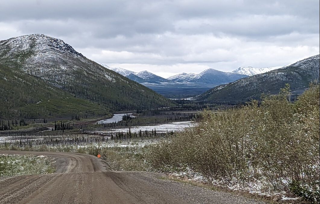 We ventured off the highway at Yukon River Camp, just past the Yukon River Crossing. The camp offers fuel, a restaurant, snacks, a gift shop, and lodging. Although accommodations here and at all stops along the highway are designed for truckers and pipeline workers, not travelers, we found the people we encountered very friendly. We topped our fuel tank at a jaw-dropping $7.49 per gallon price for diesel. (We paid $4.19 per gallon in Fairbanks before hitting the highway.) Our next stop was about 60 miles away for a photo op at the Arctic Circle sign, marking the northernmost point we had ever visited. About 20 miles later, we passed through the tiny town of Prospect Creek. Since we drove right through, we’re not sure what it offered, if anything. 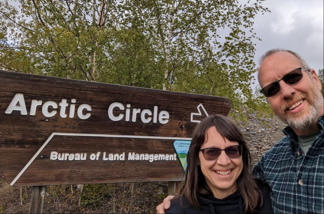 We pressed on for another 38 miles to Coldfoot, about the halfway point on the trek. Because of that status, Coldfoot is a popular stop and offers a restaurant, lodging, and fuel. Although we didn’t really need more diesel, we took advantage of its availability to ensure a successful journey in the off chance that Deadhorse would be out of fuel when we arrived. We reached Coldfoot around dinner time, our stomachs rumbling for sustenance. Hungry and cold, we decided to spring for $25 each for a warm, ready-made meal. The restaurant’s buffet featured a salad bar, pulled pork soup, sausage with pasta, steamed vegetables, mashed potatoes, and bread, with mango rice pudding and lemon bars for dessert. It hit the spot. Atigun Pass Finding internet availability in Coldfoot, we checked the weather for Atigun Pass, a 4,739-foot route through the Brooks Range, about 70 miles away. The reports showed snow and rain in the morning forecast. Not wanting to drive through unfamiliar, potentially precarious territory in wet, sloppy conditions, we decided to continue on with our drive, a feat made easier by the Arctic’s midnight sun. Nothing could have prepared us for our journey through the beautifully snow-capped mountains standing guard at the pass. White snow flurries flew at our windshield as we ascended seemingly into the clouds. As the outside temperature dropped from 30 to 20 degrees, we gawked at our surreal, mesmerizing surroundings, feeling tiny in the vastness around us. 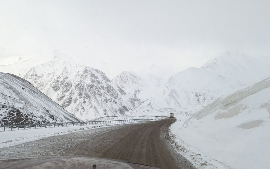 We successfully followed two semi-trucks through the mountains and had planned to stay at the primitive Galbraith Lake Campground just beyond the pass. Arriving there at 10 p.m., we found icicles hanging from the picnic tables in the 24-degree weather. That combined with a missing toilet seat in the outhouse and rain in the forecast convinced us to move on. Boondocking in the Arctic That decision took us to a slightly warmer temperature — 30 degrees at 11:20 p.m. — but we had to navigate the worst section of the Dalton Highway, forcing us to go 20 to 25 mph to reach our stopping point for the night, near pipeline pump station 3. Although you can find established campgrounds in some areas along the highway, the Haul Road offers numerous turnouts where travelers can pull over and camp overnight. We set up our tent in the bed of the truck, snapped a picture of the midnight sun, and settled in for some shuteye. Fortunately, I had taken an eye mask to block out the light, which didn’t bother Bob. The freezing cold didn’t make for the best sleep. We awoke numerous times. Traditionally, any time we camp, my charge is to take “too many blankets.” I thought I had done that, but I quickly learned otherwise. We had to use two underneath us to block the cold permeating through the air mattress. Thankfully, Bob had purchased a box of Sport Temp hand warmers* that we tucked around our feet and bodies to make the night bearable. We heard a strange animal sound over and over again and weren’t sure what it was — or how big the animal it came from. At one point, we both thought we heard footsteps. A bear perhaps? The next morning, we didn’t find any footprints (not that we really looked), but we did figure out what animal made the strange noise: a ptarmigan, Alaska’s official state bird. (It’s not the mosquito after all.) We had seen a couple of ptarmigan before arriving at our stop for the night. After repacking all our blankets and tearing down the tent and air mattress, we boiled water for coffee and a Peak Refuel backpack breakfast.* Fueled and caffeinated, we hit the road for the last leg of our journey to Deadhorse, where we had chartered an Arctic Ocean Shuttle for 3:30 p.m. We saw four caribou and a number of waterfowl on the way. 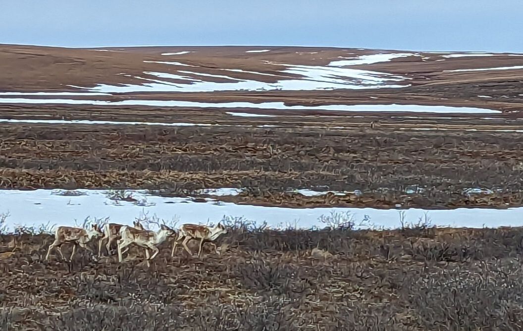 Deadhorse Deadhorse is a very industrial community, owing its livelihood to pipeline and related workers. It features hotels (most rooms with twin beds), a general store, an auto parts store, a couple of fuel stations, and a post office. While in the general store, we heard one visitor ask where she could get a good hamburger. She couldn’t. The workers eat at their place of lodging. Each of the “hotels,” or camps, offers a buffet for breakfast, lunch, and dinner, with set times and changing menus. The workers are busy, and many work long days or nights. Due to security around the oil fields, unaccompanied visitors are not allowed in. Getting to the Arctic Ocean requires purchasing a tour at least 24 hours in advance to allow time for a background check. 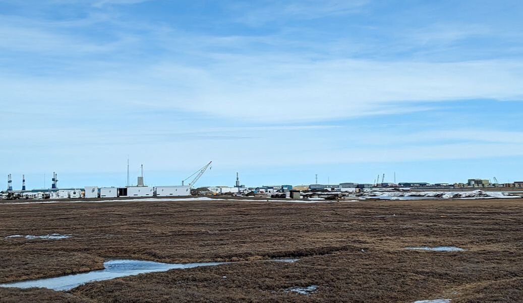 Arctic Polar Bear Club An Arctic Ocean tour includes the option to dip your hands, feet, or even whole body into the frigid water. We had been psyching ourselves up for months to take a polar plunge. Because of cold, windy weather, I nearly opted out. Bob and two others in our group of five had decided they would jump in. Not knowing if I’d ever be in the area again and wanting to live each day to the fullest as a cancer survivor, I couldn’t pass up the opportunity. Our tour guide navigated us through the oil fields, sharing interesting facts and pointing out important sights. I didn’t hear much of what he said as I was focused on mental preparation for the feat ahead. We reached our destination and emerged from the tour bus, fully clothed. Quickly taking in the beauty and capturing it in photos, we worked our way to the beach and started undressing in the 38-degree outdoor air, the wind prickling our skin with goosebumps. 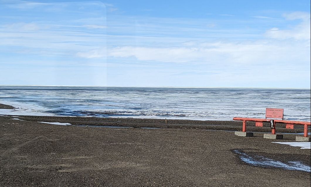 The sun had come out to spotlight our lunatic behavior. Eager to do the deed and get it behind me, I gingerly stepped down to the water and put in a foot. It didn’t feel too bad — not like the Atlantic Ocean in May when Bob and I had waded in with my dad, our feet nearly instantly numb. Ice atop the Arctic Ocean limited where we could take a dip. I wandered to a somewhat deeper, though still shallow, section and lay down in it. Bob followed and did the same. “How long do we have to stay here?” I asked, splashing water on my front so I wouldn’t have to turn over. The deed done, I sprang out of the water to the welcoming warmth of the sun, feeling very alive. 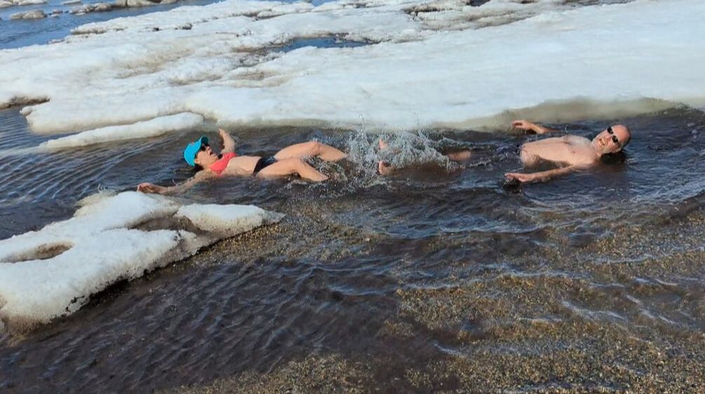 As I dried off, I marveled at how I didn’t feel terribly cold, at least not with a towel around me. We put our clothes back on and posed for another picture before returning to the bus. We did it! We became official members of the Arctic Polar Bear Club and received certificates to prove it. 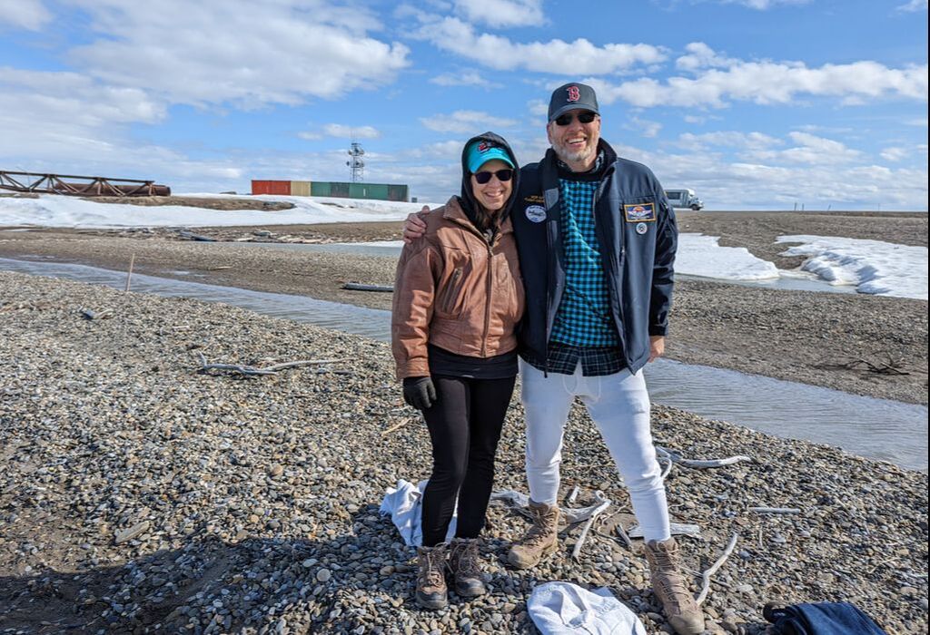 Cultural Immersion Not wanting to sleep in our cold tent that night, we decided to splurge for a hotel. The price at The Aurora Hotel seemed a bit steep until we learned it included our meals. Warm food, a warm bed, and a warm shower — out of the rain, the truck, and the bumpy road conditions — held great appeal. And this hotel had some rooms with queen beds in them. The stay proved to be one of our favorite parts of our trip on the Dalton Highway. It gave us a good taste of the culture of the industrial area that is Prudhoe Bay. Pipeline and other workers spend a great amount of time there to protect a major part of the country’s infrastructure. To get any kind of food or rest in the town requires entering their world. We enjoyed learning about their jobs and lives. We lingered until after lunch the next day so we could get our money’s worth and start our return trip with full bellies. Since the weather looked good over Atigun Pass, we decided to drive to Coldfoot and evaluate our options. When we arrived, the weather didn’t make us want to set up our tent. So, we purchased coffee and journeyed onward to sleep in our nice warm bed, well wroth the 11-hour drive. Although Gulliver took a beating, we had a wonderful Alaska adventure. You might also like Driving an RV Across the Chesapeake Bay Bridge-Tunnel. * As Amazon Associates, we earn from qualifying purchases. 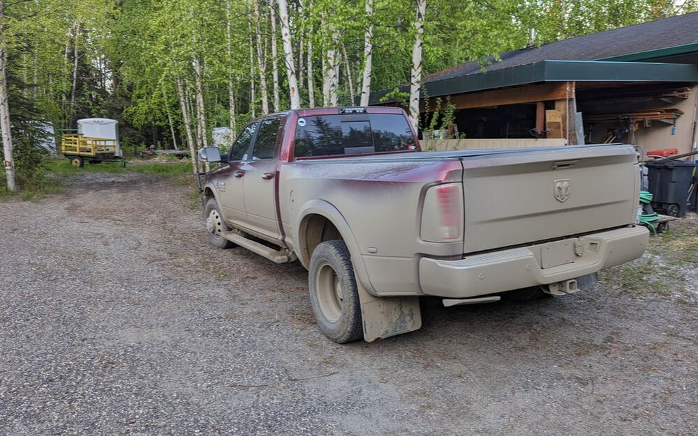
7 Comments
 The majority of the Alaska Highway ventures through Canada: 613 miles in British Columbia and 577 miles in Yukon Territory, presenting brilliant scenery. The sparsely populated towns along the way can be welcome respites from the remoteness most of the roadway holds. Some offer unique appeal to weary travelers. Here are five amazing things we saw on the Alaska Highway: 1. Muncho Lake 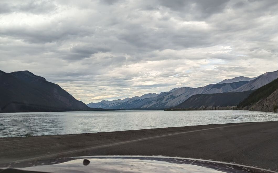 You can’t help but see this beautiful body of water in British Columbia as the Alaska Highway meanders right next to it starting around mile 436. Getting to Muncho Lake involves navigating the summit of Stone Mountain, known for Stone sheep and sudden weather changes. What makes this lake impressive is its stark greenish-blue water (which our camera didn’t capture) and the fact that it’s one of the largest natural lakes in the Canadian Rockies. Camping options are available along the water. Because it was raining and a Canadian holiday weekend when we went through, we didn’t stop. 2. Liard River Hot Springs 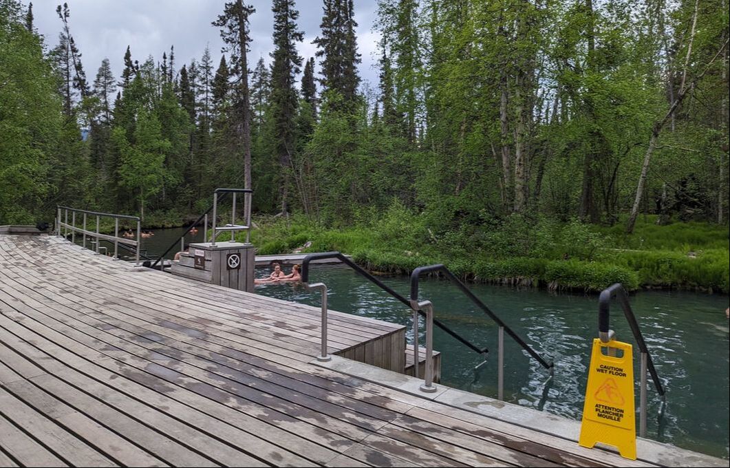 Located at mile 471, Liard River Hot Springs in British Columbia has been attracting visitors to its naturally heated pools since well before the construction of the Alaska Highway. Today, the springs are protected and operated by the Kootenay Forest Services and are well worth a stop. Having left Dawson Creek on a Saturday, we booked a campsite at the hot springs for Monday so we could take our time getting there. Because of expected rain in the area on Monday, we drove farther than originally planned on Sunday and arrived at about 6 p.m. to find a very full campground. We parked in overflow parking, paid $26 (Canadian or American; there’s no exchange rate here) for an additional night, and were granted access to the springs. A nearly half-mile boardwalk over a marshy area takes visitors to the Alpha pool, where the warmth of the water varies. It’s hottest where it enters the pool and coolest at the other end. The temperature isn’t evenly regulated from top to bottom. Heat comes in waves, and you can often feel cool water on your feet. 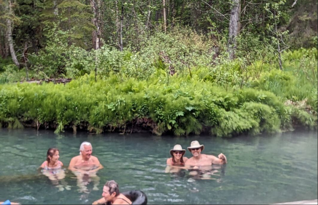 Across the street from the Liard River Hot Springs Provincial Park is Liard Hot Springs Lodge and RV Park, which features a restaurant and Wi-Fi (for a fee). Although primitive (with no hookups), camping at the provincial park includes access to the springs in its nightly fee. If you don’t want to spend the night, you can still enjoy the springs for a $5 per-person day-use fee. 3. Sign Post Forest 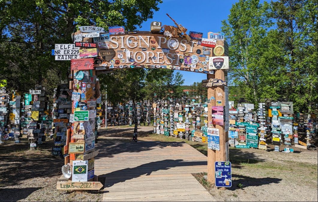 At mile 612 in the town of Watson Lake, Yukon Territory, you’ll find a truly unique tourist attraction that dates back to the time of the creation of the Alaska Highway. When one of the engineers was sent to the Watson Lake area to recover from an injury and assigned to repair and repaint directional signs, he felt homesick. So, he added a sign to his hometown of Danville, Illinois, to an existing signpost. As others on the Alaska Highway came upon the signs, they decided to add their own as well, and Sign Post Forest was born. Today, it features more than 100,000 signs in all shapes and sizes. 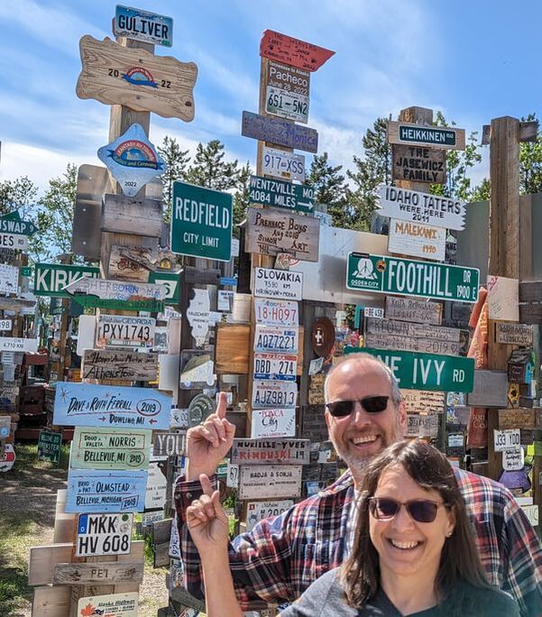 We showed up prepared. South Dakota sent us a new license plate this year as the state changed the color of “South Dakota” on its plates. So, we took our old GULIVER plate and posted it in a prominent spot atop one of the numerous posts. You’ll have to see if you can find it if you’re ever there. 4. Kluane Lake 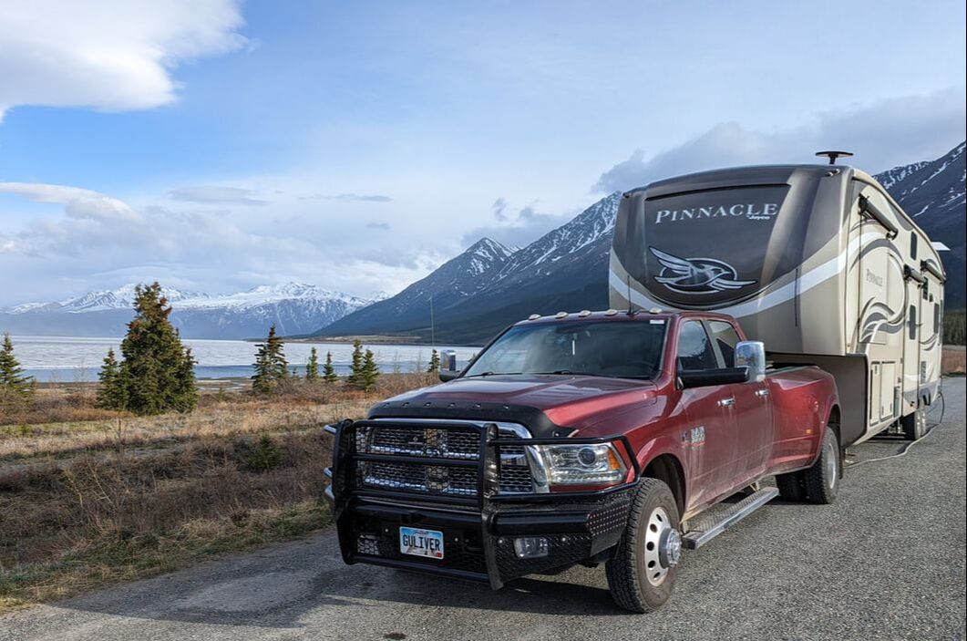 At about mile 1,001, a magnificent, 50-mile-long lake — Yukon’s largest — comes into view. The highway skirts Kluane Lake, offering scenic turnouts for photo opportunities of the expansive body of water against the backdrop of the Kluane Ranges mountains. We were privileged to spend a chilly night in this area, basking in God’s amazing beauty around us. We walked down to the lake and put a hand in. The water was quite cold, as we expected, since a thick layer of ice still covered much of it. 5. Wildlife 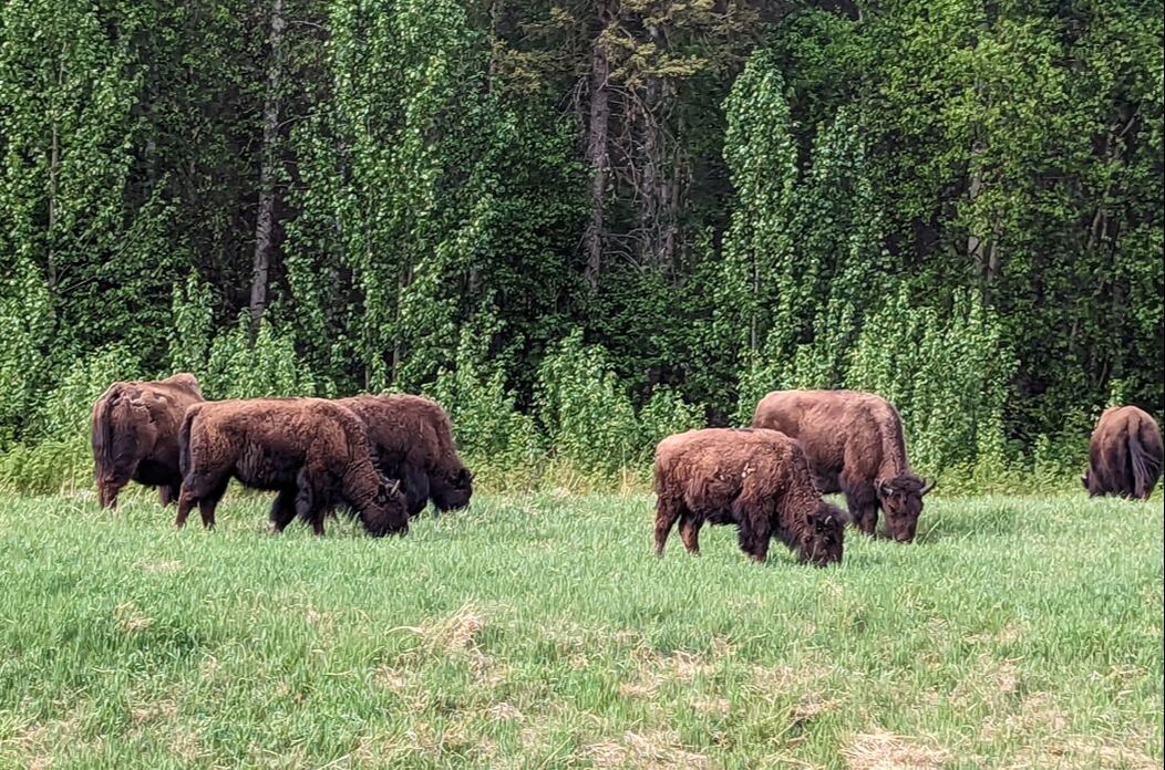 Part of the excitement of driving the Alaska Highway is seeing wildlife along the way. I got excited every time we happened upon an animal in its natural habitat. (Somehow, I don’t think the feeling was mutual.) We were thrilled when we spotted a family of four bears (a mama and three cubs) out for a Sunday picnic. A little later, we saw another mama bear with a single cub. 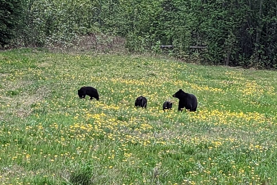 Driving through the Stone Mountain summit pass lined by rocky cliffs, we caught sight of a Stone sheep but didn’t have time to take a picture. As we journeyed on, a mama bison and her calf crossed the highway in front of us. Before much longer, we encountered a herd of bison on the side of the road. At Liard River Hot Springs, a moose cut across the boardwalk as we approached. 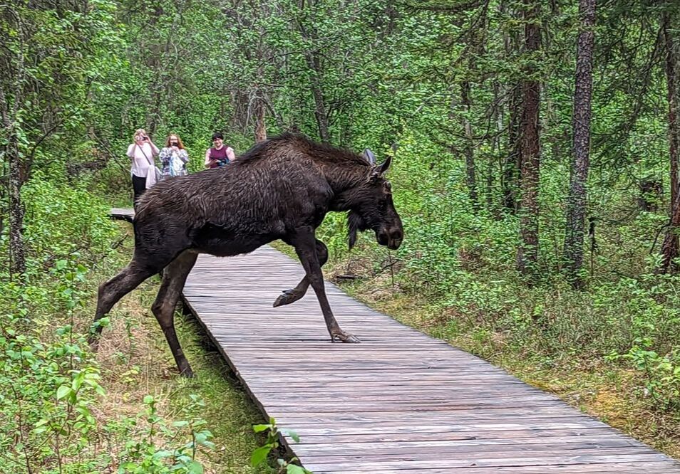 We also ran across a deer, another moose, more bears, more bison, a porcupine, and a bald eagle. Oh, and we can’t forget Alaska’s “state bird,” the mosquito. 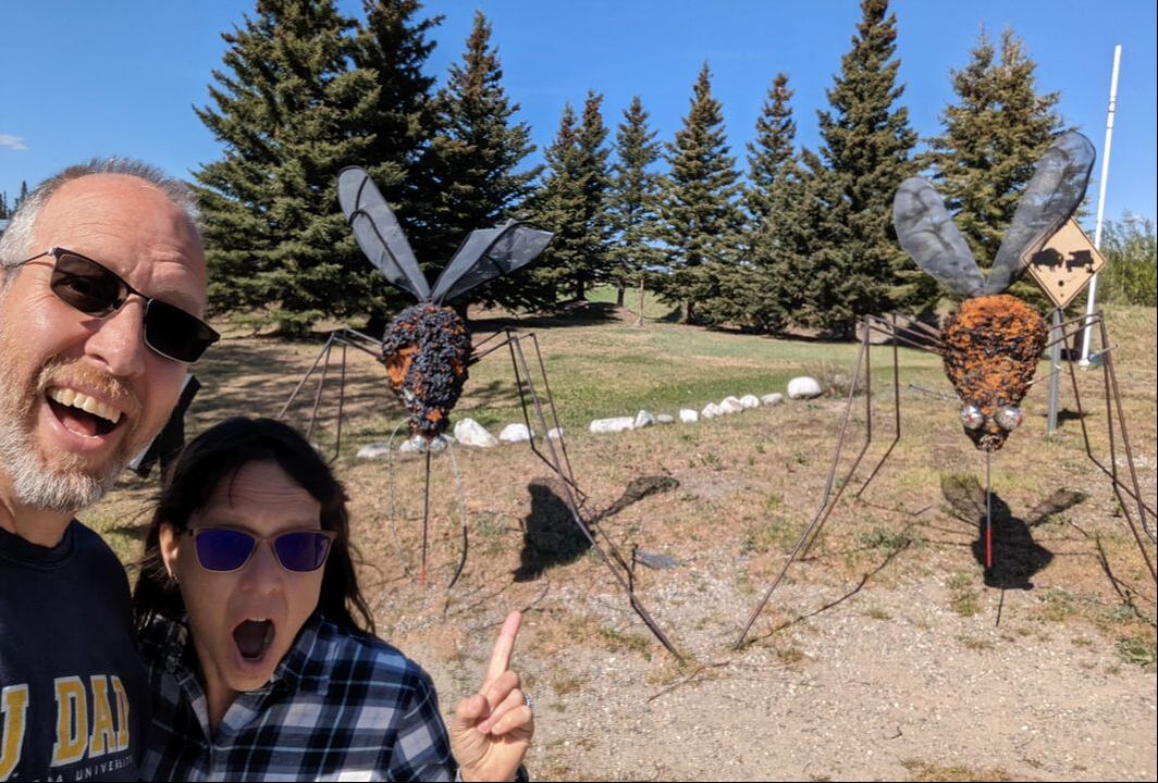 We’re grateful for the opportunity to drive the Alaska Highway and for all the beauty we got to behold on our journey. We are truly blessed.
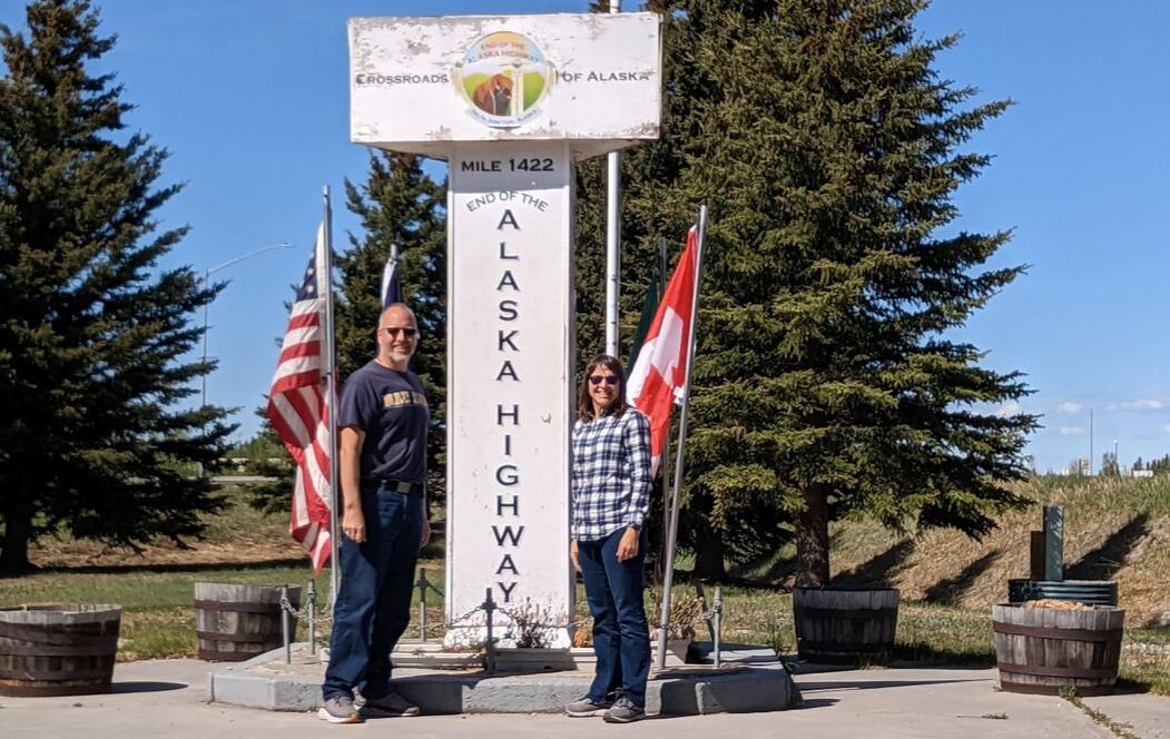
You might also like Magnificent Rock Formations. 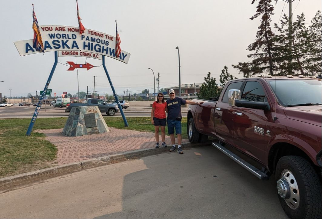 The Alaska Highway stretches 1,387 miles, starting at Dawson Creek, British Columbia, and ending at Delta Junction, Alaska. From the contiguous U.S. to Alaska, it seems like there would be a more direct route than from Dawson Creek, which is practically to Alberta and considerably north of the Canadian border. When the highway was created in the 1940s, it was done so for military reasons after the bombing of Pearl Harbor, which made a land supply route pertinent. Much of the roadway’s purpose was to connect air bases between Edmonton, Alberta, and Fairbanks, Alaska. Prior to the attack on Pearl Harbor, plans had been drafted to build a connecting route between Alaska and the contiguous U.S., but Canada didn’t see much benefit to investing in such a highway. After Pearl Harbor, however, Canada was more willing. The U.S. agreed to pay for the construction of the highway and turn over the Canadian portion to Canada six months after the end of the war. Construction commenced in 1942 and took eight months and 27,000 workers to complete. The roadway didn’t become public until 1948. Today, it carries approximately 300,000 travelers a year. Dawson Creek, British Columbia Dawson Creek marked the end of the Northern Alberta Railway in 1942, so that’s where American troops and supplies arrived to begin the great construction project. Because they started there, Dawson Creek is the official starting point for the journey of a lifetime, signified by a world-famous cairn and sign. The sign is flanked by an iconic landmark labeled Alberta Pool Elevators Ltd. Dawson Creek, which houses an art gallery now. In the same complex stands the visitor center, featuring a museum of the Northern Alberta Railway Station, Dawson Creek souvenirs, and super friendly staff who eagerly share valuable information. The visitor center also showcases a replica of the original mile 0 post, which can be found just down the street in the middle of an intersection. 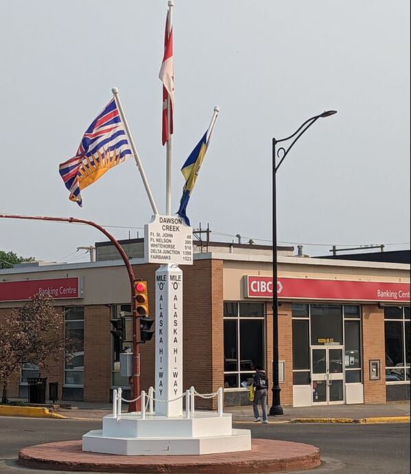 Dawson Creek is a great place to spend a few days to wrap up preparations for a days-long journey on the Alaska Highway. We spent a week at the Mile 0 Campground (actually at mile 1.86) for that very reason. We fueled up, restocked our supplies (with three grocery stores to choose from), did laundry, and took care of maintenance. We took Tagalong, our fifth wheel, to United Spring & Brake Ltd. to check our grease-neglected suspension. The trustworthy guys there gave the complete suspension system a thorough examination. They replaced and greased all the wet bolts and brash bushings. And they reversed the zerks, or grease fittings, so that they face the underside of the trailer, making future grease jobs easy endeavors. We’ll no longer have to remove the tires for that. The workers also discovered one of the trailer’s leaf spring hangers had partially broken. Since they didn’t have a replacement in stock, they welded it to strengthen and secure it. All that work took only 3.5 hours and was a very reasonable price. We highly recommend any RVer visit United Spring & Brake before driving the Alaska Highway. Starting on the Alaska Highway With all of those things done, we were ready to set out on our Alaska adventure. Our trip got off to a smoky start, thanks to a wildfire burning about 47 miles away. We trudged through with limited visibility for about 1.5 hours before the smoke finally cleared to reveal blue sky. 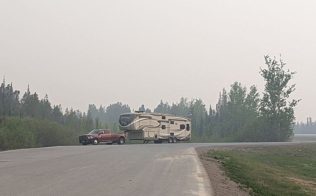 Unlike widely accepted rumors about treacherous driving conditions, we found the road to be in great shape. The highway had a reputation in the 1950s as being a “hazardous journey.” That belief has largely proliferated and is the reason you likely hear more about camper vans, truck campers, and class C motorhomes as the prominent vehicles traveling the highway. 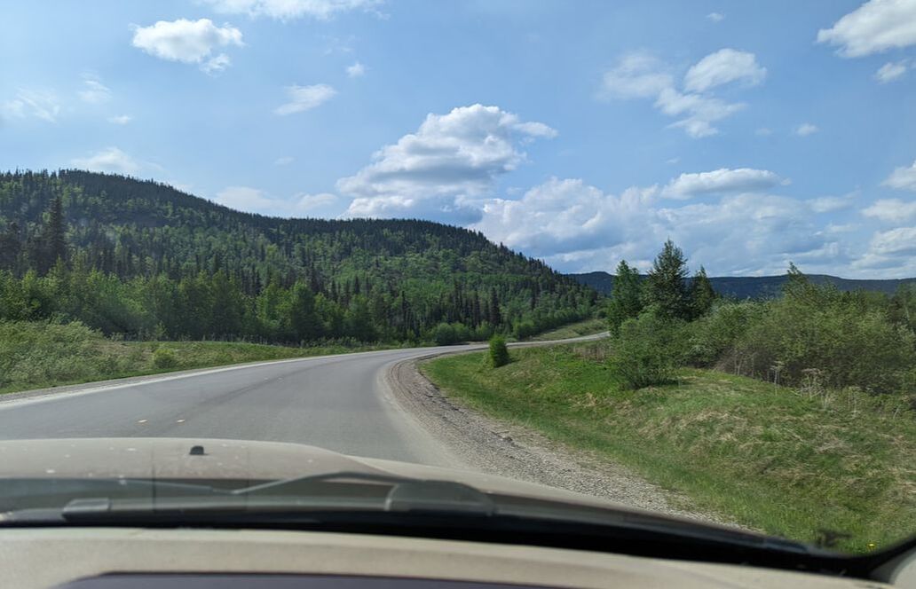 Believing those rumors, we considered downsizing from our 42-foot-long, 13.25-foot-tall fifth wheel to a truck camper to make the trek. But it wouldn’t be the same without Tagalong with us. We decided to take the risk, and our home, on the journey. Having traveled about half of the Alaska Highway in our fifth wheel, we can say with confidence those commonly held beliefs are indeed rumors. After all, semi-trucks, many with double trailers, regularly navigate the highway. The road is completely paved (and has been since the 1960s), other than a few short stretches of gravel where construction is underway. The highway is extremely well maintained. Bumpy areas are clearly marked, and white circles outline problem areas that need to be filled. We found the highway to be in better condition than many of the roads we’ve traveled in the contiguous United States. 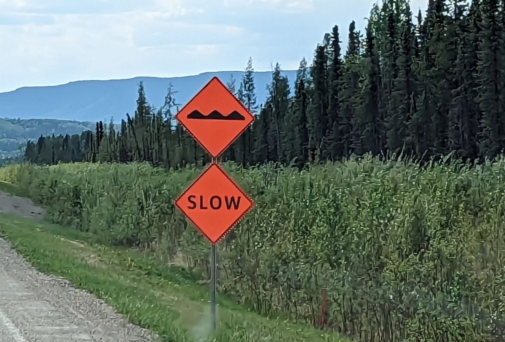 With lots of time passing and hardly seeing any other vehicles, we felt like the road was made just for us.
You might also like 6 Biggest Surprises of Full-Time RV Living. 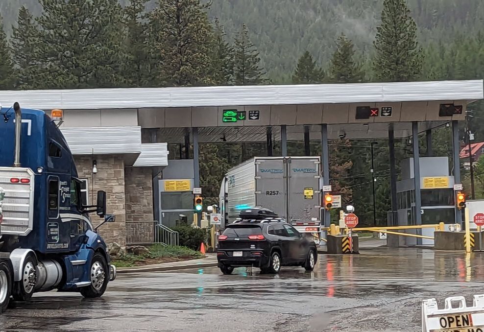 Canada offers a lot of beautiful scenery: majestic mountains, towering evergreen trees, massive bodies of water, bright green grass, abundant wildlife, and quaint towns. Many RVers enter the country for a peaceful camping experience. We had a trek to Alaska in mind, which requires driving through British Columbia and the Yukon. We had done a little research before crossing the Canadian border to find out what we could take, what we couldn’t, and special requirements. We learned there were restrictions on chicken and eggs but that fresh produce was OK to bring. After watching videos of other RVers’ border crossings, we realized the Border Services Officers didn’t tend to request much in the form of paperwork. We felt prepared to enter the country and decided to cross at Eastport, Idaho, as we were working our way from Eugene, Oregon, to Dawson Creek, British Columbia, for the official start of the Alaska Highway. 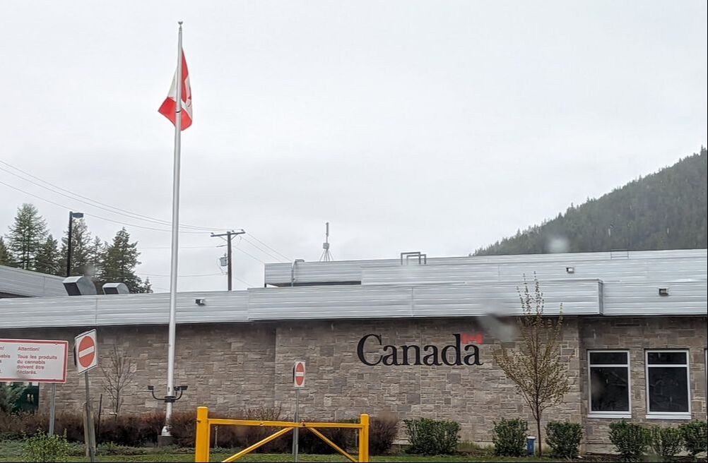 Interrogation We reached the border crossing and stopped behind a semi-truck. After about 10 minutes in line, it was our turn to approach the border inspection station, where we handed over our passports and were greeted with a battery of questions:
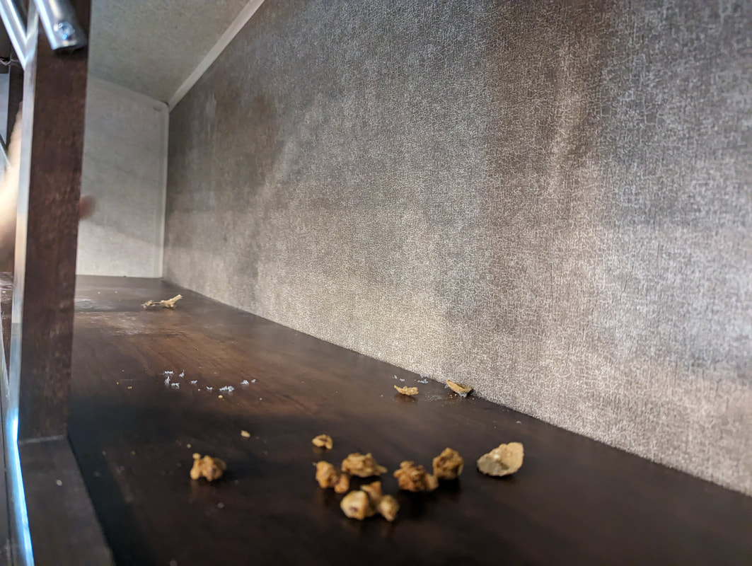
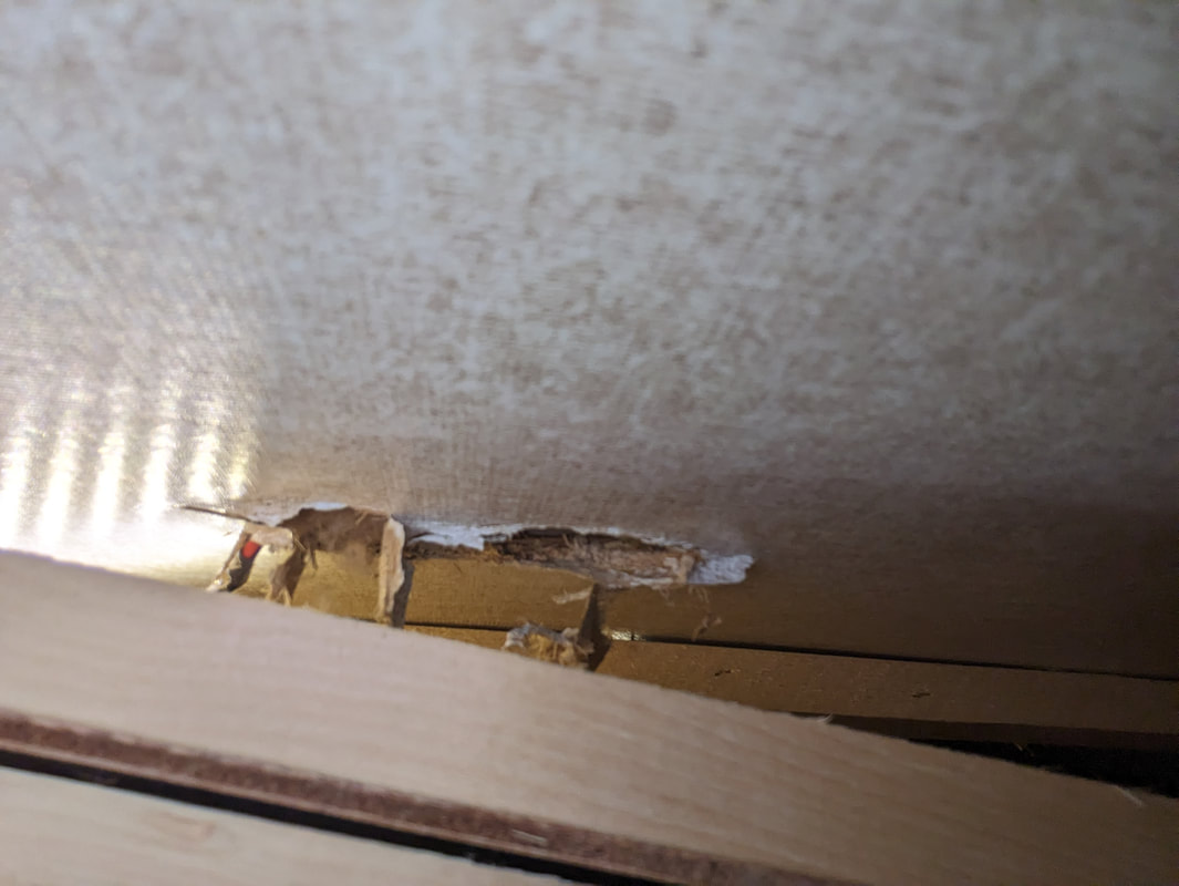
Because we live in our RV, we often answer the “Where are you from?” question by saying we’re full-time RVers. Thankfully, Bob remembered to provide our legal city and state: Sioux Falls, South Dakota. We assured the officer no one was traveling with us. We didn’t know at the time that we had a stowaway (more on that later). Excitedly, we shared that we were headed to Alaska and would be in the country fewer than 30 days. Bob enjoyed telling the officer that I worked as an editor and that his job was to “keep looking this good.” Bob volunteered that we were carrying two rifles and had paperwork for them. That led to another question: “Why are you carrying the rifles?” We answered for protection against dangerous wildlife. Bob also volunteered that the rifles and the ammo were locked separately. The agent asked where the rifles were. We told him. Then the officer asked if we had any other weapons. We told him we left them behind in Arizona. He asked what we left behind. Bob rattled off the list. The guard asked if we had any pistols with us. We assured him we didn’t. He asked if we had any other ammo for guns we didn’t have in our possession. We told him no. We remembered we had a small canister of CBD cream we had picked up about three years earlier and divulged that information. We had purchased it for its supposed benefits for bodily aches and pains. After a few uses, we weren’t convinced it really worked. In-Person Encounter Because we had rifles and the necessary paperwork to carry them through the country, we had to park and go inside the building. The guard told us not to take the rifles with us, to leave them where they were, but to take the CBD cream. We obeyed. Inside the building, we presented our paperwork and the CBD cream to another official. We paid a $25 fee to carry the rifles. The officer told us they’d accept anything but American cash. As for the cream, it seemed to be problematic as cannabis and CBD items are controlled substances in Canada. As such, it required extra paperwork for the Border Services Officers but not for us. We offered to surrender the CBD cream if that would make things easier. The agent told us that was going to happen anyway. Because of that extra paperwork, we had to show an ID. Since our driver’s licenses didn’t display our current address, the official also requested to see our truck registration. I ran out in the rain to get it. We saw another fifth wheeler get turned around back to the U.S. for having what looked like some sort of vape device. After showing our truck registration, we got our rifle paperwork back along with a receipt for our payment, and we were free to tour the country — about 20 minutes after arriving at the border crossing. Illegal Immigrant(s) We didn’t know we had smuggled a stowaway into Canada until later that night, when we heard scurrying across our ceiling as we tried to sleep. The day before, we had discovered evidence that a rodent had found its way into our rig. Since we were boondocking in Eastern Washington state at the time, we guessed the unwelcome houseguest to be a field mouse. 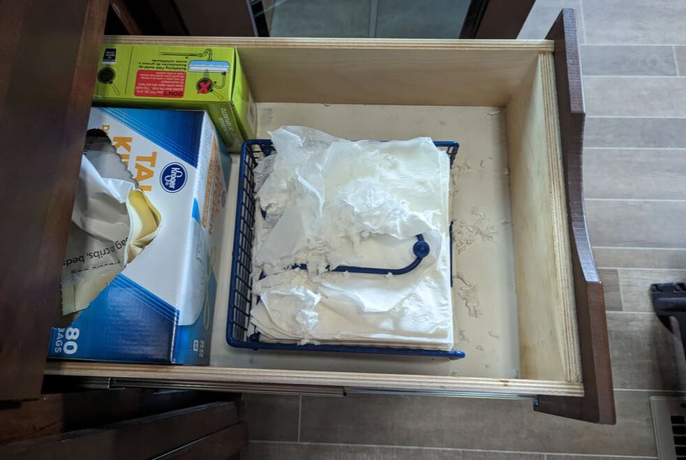 Much of our incentive for risking a rainy drive to enter Canada was to get away from field mice. We had hoped the washboard road away from our boondocking spot would be enough to scare the critter away or knock it out permanently. No such luck. After setting up at a campground in Kimberley, British Columbia, and enjoying a relaxing evening, Bob stayed up late playing a video game. A field mouse scampered across the living room floor in plain sight, uninhibited by the bright lights. (I had read that field mice don’t like light.) Ours was a rebel. We went out the next day to purchase mouse traps. Before we left, we discovered signs of a mouse in our upper cabinet, which we thought was safe from rodents. We knew if any got in there, they would hit the mother lode: baking ingredients, cereal, rice, dry beans, and pasta. How did a mouse get in there? we wondered. We removed all of the contents from the cabinet and found evidence that the mouse had chewed a hole in our interior. The creature had been traveling across our rafters, having a heyday. That’s why we had heard it overhead in bed. After returning from the store, we set out four traps. By 3 p.m., one snapped, announcing that we had caught a mouse. We reset the trap to make sure we didn’t have more rodents. That night, we didn’t hear any ceiling scurrying.
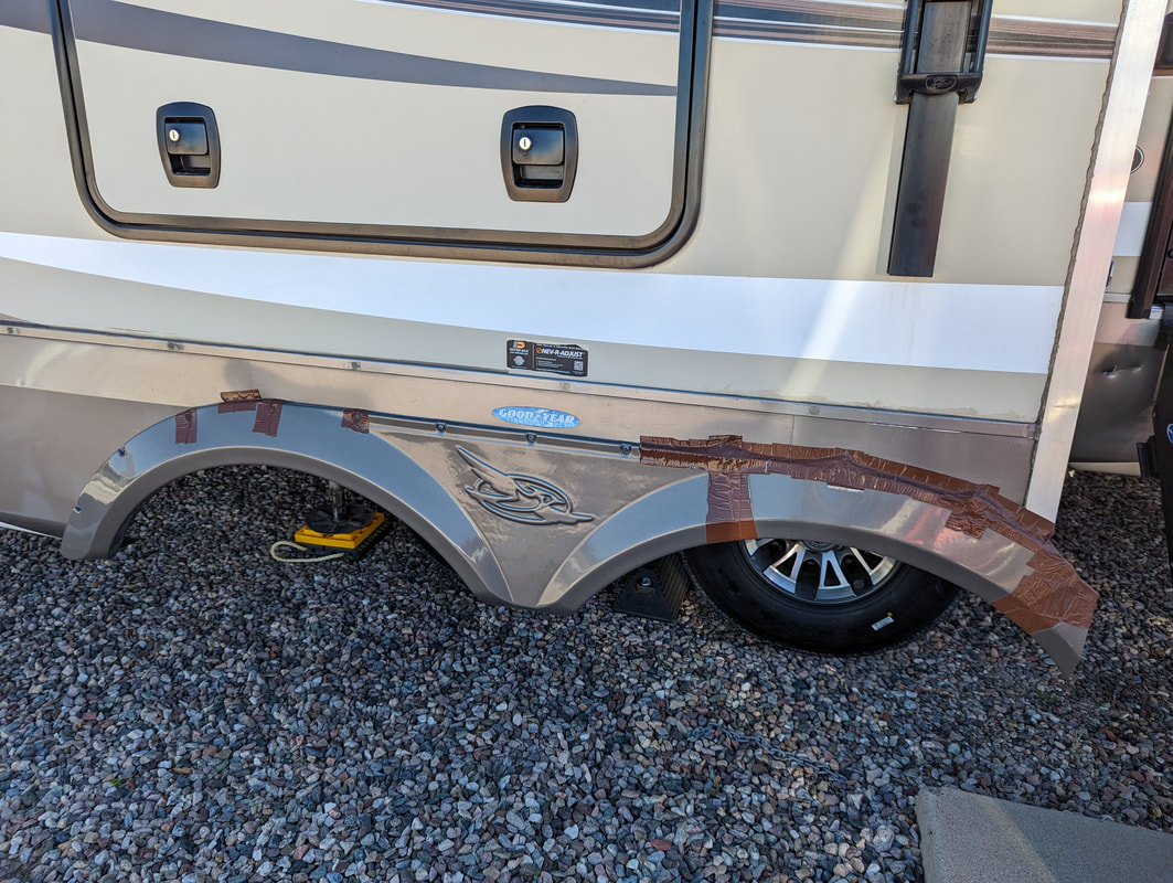
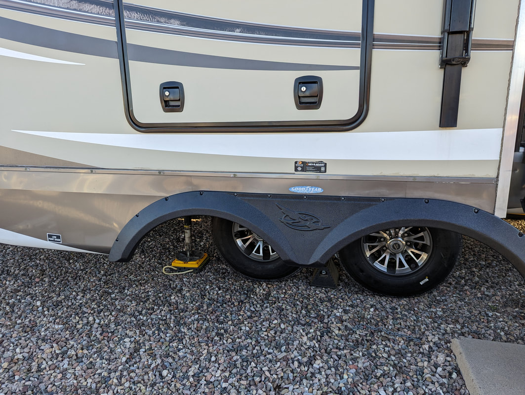
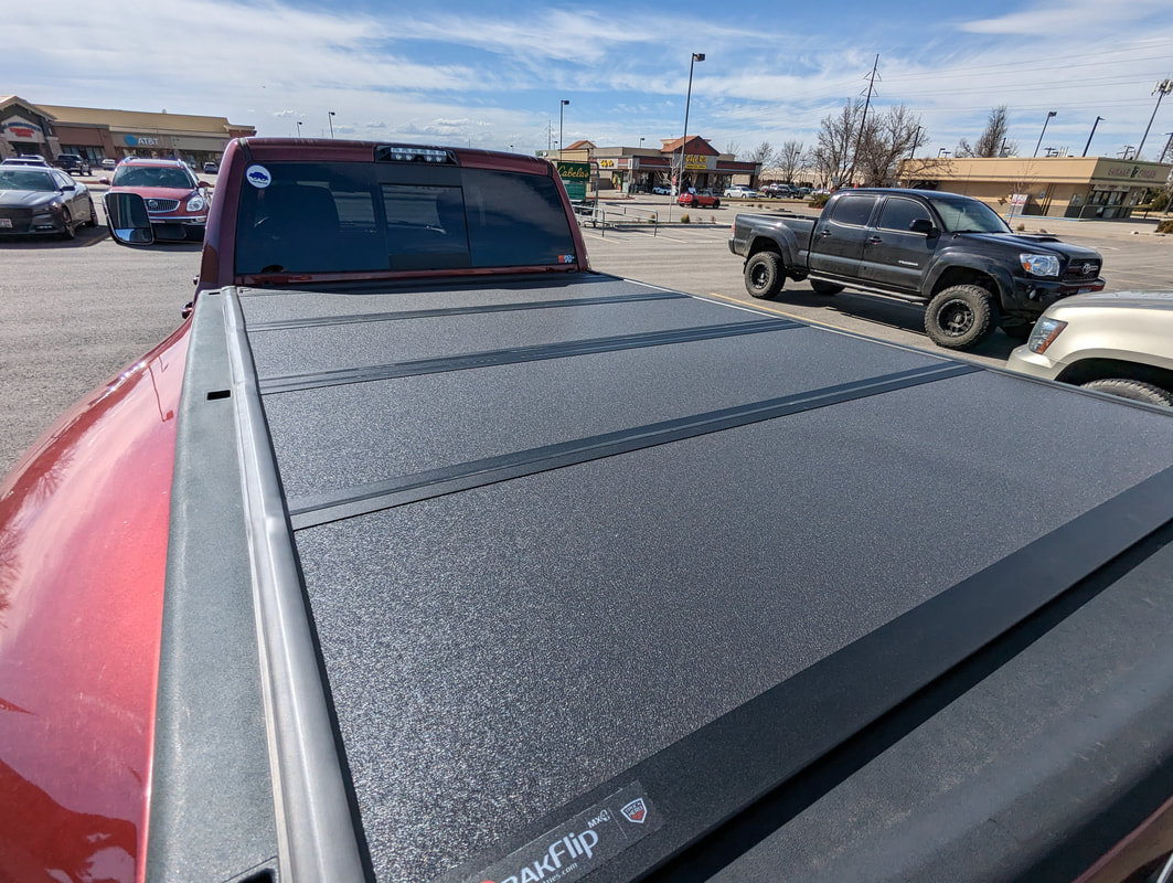
By the next morning, we caught another mouse. We reset that trap too. Better safe than sorry. Sure enough, the cycle continued, with a third trapped mouse the next day. We reset the traps again and awoke the next morning to find them all empty. We had successfully freed our rig from three illegal, unwelcome guests and could get back to normal full-time RV life. You might also like Driving Across the Border to Mexico. 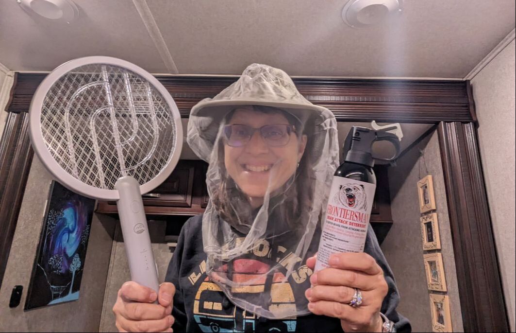 When we began our full-time RV lifestyle in 2020, we had a drive to Alaska in our sights. I’ve always wanted to experience the Alaska Highway. Since we needed to visit family in some other areas of the country first, we decided 2023 would be the year for our great Alaska adventure. Getting ready for a 1,387-mile journey through barren wilderness where wildlife roam freely, vehicles pass by rarely, and road conditions can leave a bit to be desired is no easy feat. We started plotting and planning early on, watching YouTube videos, listing items we’d need, and accumulating them over time. After three years of RV living, we certainly feel more prepared than we would have if we attempted to make the journey when first starting out. We’re glad we talked to others who successfully made the trip and eagerly shared tips and tricks. Here are the things we picked up in anticipation of what lies ahead in the Last Frontier. Vehicle Upgrades The first thing we did was add shocks to the trailer to help with the frost heaves and potholes that are common on the road to the 49th state. To ensure we could travel long stretches where fuel might be scarce, we upgraded our 32-gallon diesel fuel tank to a 55-gallon tank. Since wildlife are known to approach and cross roads in Canada and Alaska, they posed a risk to our vehicle. To give us the best chance at escaping an accidental run-in with an animal, we replaced Gulliver’s front bumper with a beefy grille guard. Tires often take a beating on the rough roads to and around Alaska. Knowing that, we purchased five new tires for Tagalong. We didn’t just get new tires, though. After four flat tires in one year, we upgraded from E-rated to G-rated tires, which are better equipped to handle our heavy load. We also got six new tires for Gulliver. (Can you say cha-ching?) Bob finally got to reclaim his pride from the mishap on the first leg of our initial RV journey. We replaced the broken fender skirt held together with duct tape. When we realized the opposite side’s fender skirt screw holes had become brittle, we replaced it too. When our BAKFlip tonneau cover for the bed of the truck broke at a seam, Bob jerry-rigged a temporary fix with ratchet straps and screws. That did the job and kept snow, rain, and dirt out until we could replace it. It’s nice to have a new one without dents or hail damage that works the way it’s supposed to. Personal-Use Items We invested in Starlink internet, which works anywhere on the continent that the dish can see the northern sky, as the technology is based on low-orbit satellites. Alaska got Starlink service at the beginning of 2023 — great timing for us. To give ourselves the best chance at a successful journey, we lightened our load, storing our handguns (not allowed in Canada), Davy Crockett pellet smoker/grill, lounge chairs, and various other items we could do without for a year. We also sold our little electric bikes, giving us more space in the back of our truck cab, where we used to stow them for travel. Alaskans joke that the mosquito is the state bird. We’re told the nagging insects are big enough to see there. We bought mosquito zapper racquets and face netting to protect ourselves from bites. We also secured some bear spray, which is highly recommended to have while traveling through Canada. We’ll be in some pretty remote areas where the animals can be common. The spray is essentially tear gas for bears. Knowing items tend to cost more in Canada and Alaska than they do in the lower 48, we stocked up on some grocery staples and standards we like to have on hand. In addition, we bought a jug of diesel exhaust fluid, a necessity to keep Gulliver trucking along. It may not be available at fuel pumps in Canada and Alaska like it is in the contiguous United States. And we picked up a copy of The Milepost Alaska Travel Planner, which details pertinent information about what’s available and where along the Alaska Highway. (Thanks, Richard and Janet!) Let the Alaska adventure begin! You might also like What an RV Travel Day Is Like. |
AuthorThis is the travel blog of full-time RVers Bob and Lana Gates and our truck, Gulliver, and fifth wheel, Tagalong. Categories
All
Archives
May 2024
|
 RSS Feed